In the last few years, at Aqua Map, we have added various layers of information to the "basic" official marine cartography: Tides & Currents, Satellite images, Land data, ACOE surveys, USCG List of lights, and more. We believe that the ability to integrate different pieces of information with the typical marine chart is one of the most significant enhancements to our product. Viewing all this data properly merged together multiplies the amount of information from each of the sources.
This is a typical case where 1+1 = 3.
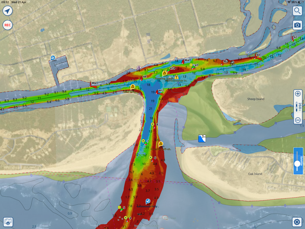
See below an example; this is Lockwoods Folly Inlet, one of the most challenging areas along the Atlantic ICW, with NOAA charts mixed with ACOE surveys (bright colors), Satellite images, USCG buoys, T&C, and Community data.

Talking about "additional info," we have received requests from our users about the possibility to search for Mile Markers along the inland waterways. The Mile Marker (also named Distance Marker) is an "ancient" way to geo-localize your position along the waterways, the very same concept as Milestones on roads.
In our first release (around 2 years ago), we added the possibility to search (on our Search page) for specific Mile Markers present in the marine charts. These Markers are typically displayed on NOAA charts every 5 miles, so you could have searched for MM 865 or 870 on the Atlantic ICW but not MM 868.2.
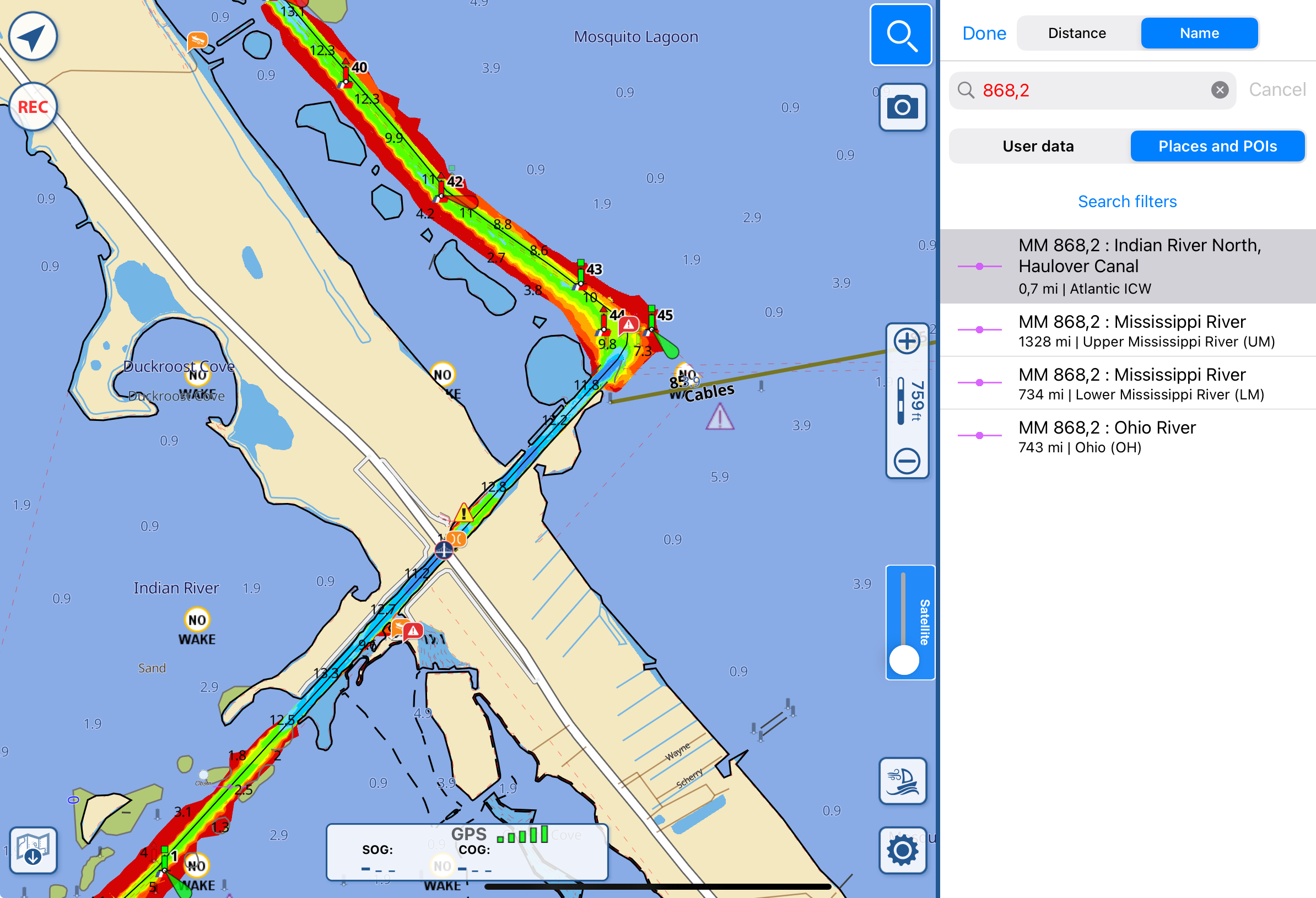
A few months ago on March 2021, we made an improvement, creating a much more powerful DB of Mile Markers where you can search for any possible MM along nearly all the most important inland waterways (currently only in the US). Now you can search for MM 868.2 along the Atlantic ICW, and the app will bring you exactly there.

We would like to highlight a few technical details on how this is done: We do not interpolate with a straight line between the original NOAA Mile Markers because, in many cases, this will lead to an incorrect calculation. This is because the waterway is not a perfect straight line. Instead, we have recreated all the inland waterway center lines, in this way we can use them to make a calculation as accurate as possible of the real position of the MM along the waterway.
Another advantage of this new DB is that you can search for the MM not only using the official name of the waterway (e.g., Atlantic ICW) but also the different local names (e.g., Indian River North, Lake Worth Creek, …).
Going back to the 1+1 = 3 concept, having this new Mile Marker DB triggered new ideas, leading us to create new interesting functionalities for our users.
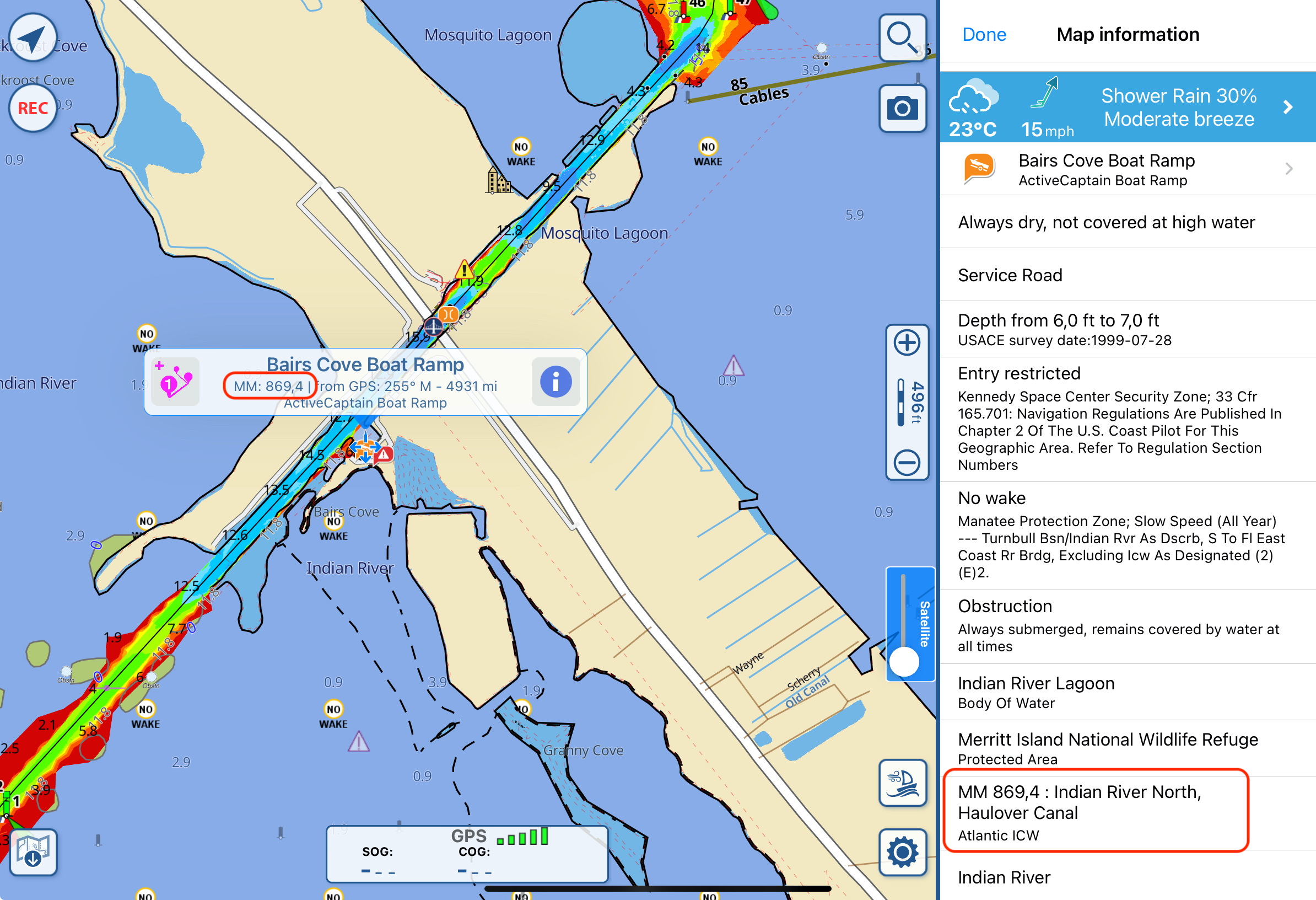
In fact, now you can tap anywhere along a waterway (as mentioned previously, currently only in the US), and on the popup that appears on the map, you can read the corresponding Mile Marker value at that position. If you start dragging the popup along the waterway, you will see in real time the corresponding MM below your cursor.
Finally, when tapping on the popup, it opens the detailed map information page. Here, one of the rows will contain all the detailed information for that MM, including the name of the waterway and the local name of that portion of the waterway.

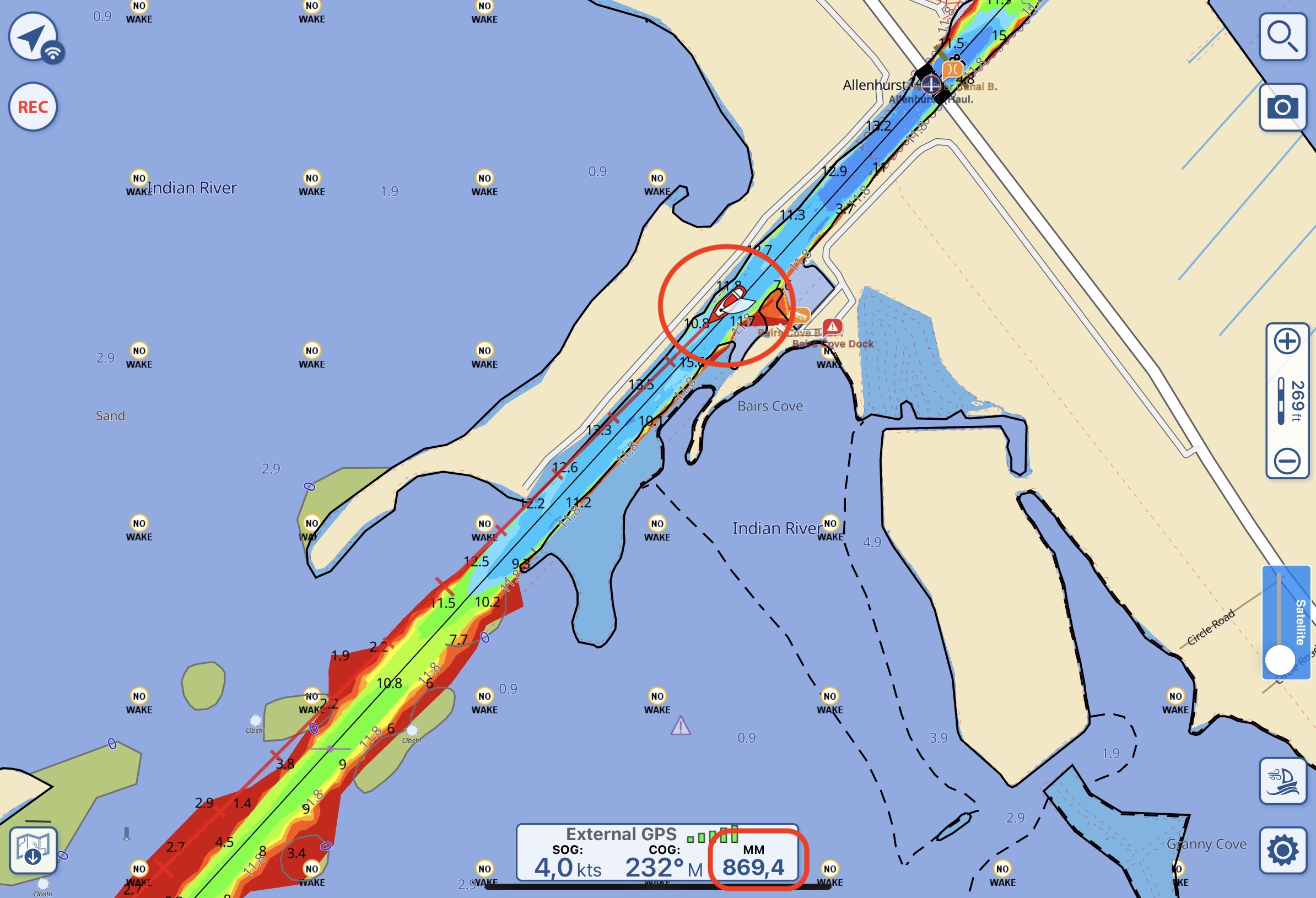
One last improvement we added is that, while you are navigating along an inland waterway, a new info will appear in the GPS (bottom-center position on the screen) window: the Mile Marker corresponding to your current GPS position.

That’s all for this feature. Thanks for your interest and stay tuned.
Claudio Bo, Aqua Map team.


