I remember the first time, more than 20 years ago, I saw the Satellite images overlaid on a map…that’s like switching on the sun in the night.
During a nightly navigation having a clear understanding of what is surrounding you, is going to really improving your confidence.
For this reason we integrated both the satellite images and the land details into our Aqua Map application.
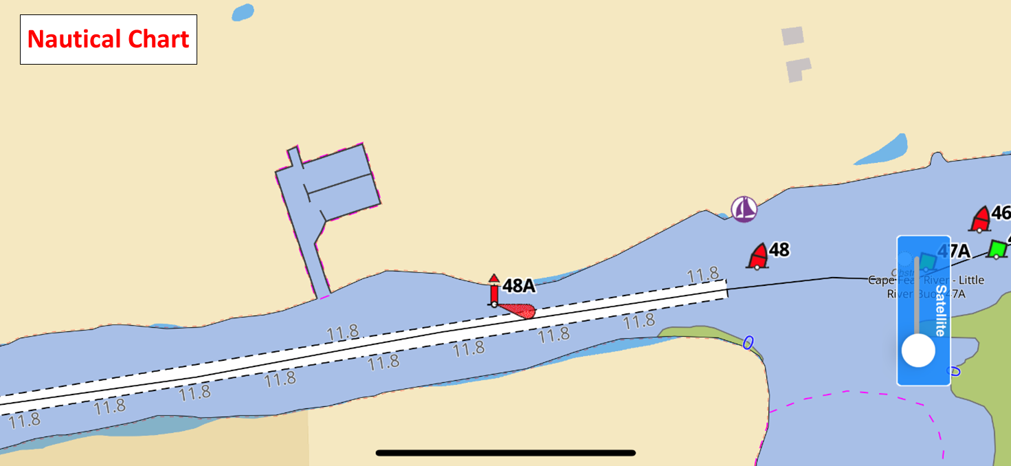
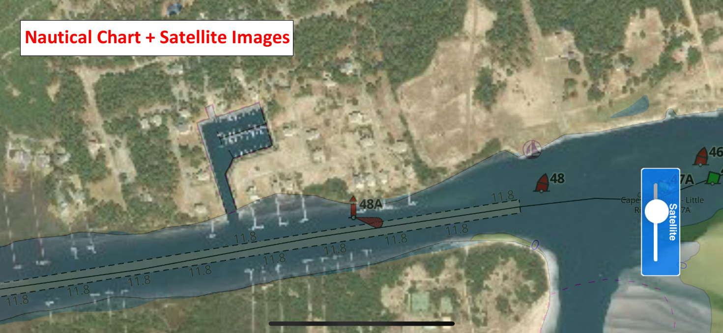
As you can see Satellite images are usually more up-to-date and may contain several more details than the best Nautical Chart for the area. In this sample you can see several, maybe private, piers are not reported into the chart. But also, the shoaling on the right is quite different compared to what is on the nautical chart.
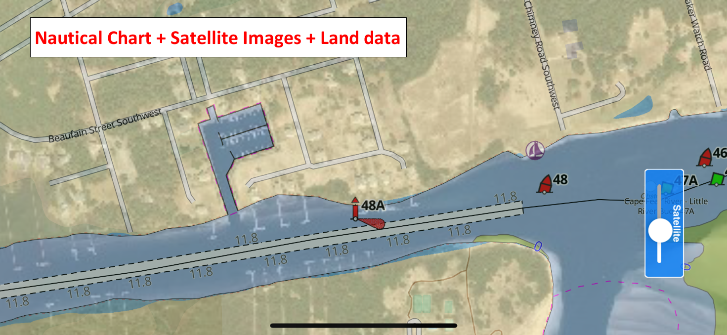
There are several areas in which the Nautical Charts are just used as a reference but not updated to reflect the reality. In this particular case we are at Lockwood Folly on the Atlantic Intracoastal Waterway (AICW) that it is a well know spot where the Nautical charts are frequently updating only the navigation aids and not the depth information (and for this reason in these areas we integrated the USACE product, but this is another story). To further improve the user experience during the navigation we included also Land details (roads and trails network, buildings, POIs, natural areas, etc.).
How many times during your navigation, you ask:
Is there a grocery store near my anchorage? Where could I walk a trail with my dogs? Is the city at a walking distance from my pier?
Turn on the Land Data from the Aqua Map setting page and start planning your on-land activities.
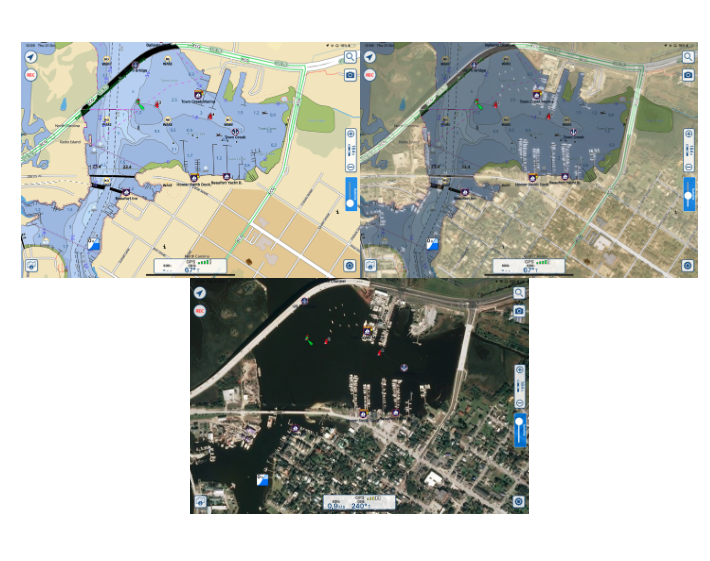
Turning on the online satellite image in the main setting menu of your Aqua Map app will display the satellite slider on the right of your screen to manage the overlay as you prefer also during navigation. You can turn on and off as well as put it halfway so you can still see depth markings and other info.
The Land data we include in our product is composed by several sources starting from OpenStreetMap, a crowd sourcing project with more than half a million contributors which continuously update their map with roads, trails, POIs and much more.
In some areas we integrated more detailed information from the local governments, like for example LINZ data for New Zealand, CANVEC for Canada, Shuttle Radar Terrain Mission (SRTM) for the elevation contours, National Park Service and National Forest Service in the USA to have detailed POIs within parks, and many more especially for the trail network. There are over 300.000 itinerary worldwide from the Appalachian Trail in US to the Via Francigena in Italy and Europe.
From the settings menu of Aqua Map you will have the possibility, under Land data item, to choose between three different types of land data display on the map.
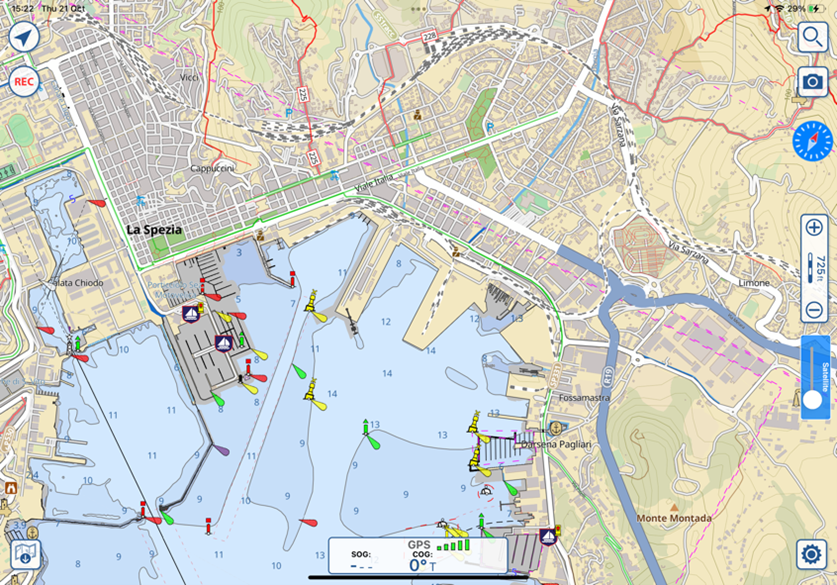
The "Normal" option allows you to basically view the layout of cities and street names as well as information on the main points of interest in the city, hiking/biking trails and much more…
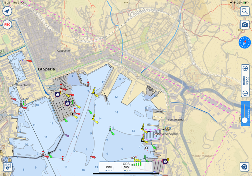
The "Faded" option displays the same info but not so evident, allowing you to give more prominence to the marine cartography information.
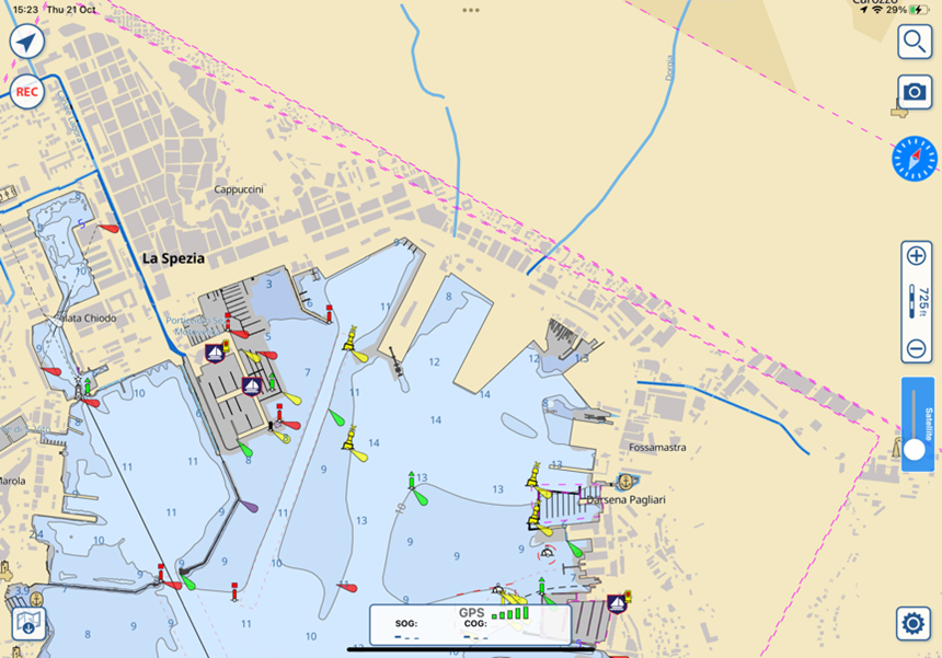
“Hidden” will make all land data disappear.
Why we put all this effort on the land data for a Marine Navigation product?
Well, for us it is almost free.
Here we come to the other product we have in our portfolio: TERRA MAP
Terra Map is an application for the GPS Trail navigation. We did not want to create another car navigator with all the classic functionalities.
We decided to work on a smaller niche and so we tried the on-land outdoor activities: mainly Hiking.
We collected all the best cartography available, as you read before. It has been integrated to obtain the best result and tiled to make the download lighter.
Same as Aqua Map, you download your tiles at home (better with a good wifi) and then you can switch off the cell connection using them offline.
Create Markers, record GPS Tracks, draw your manual Tour, shot Photos, archive everything on your GEC Account (where you already archived your marine user data)…most of the Aqua Map basic functions are available also on the Terra Map application.
Not only, the Live Sharing is fully integrated to monitor your friends while hiking on the mountain together.
As said before, there are over 300,000 (three hundred thousands) tours you can search, select and highlight on the map to ensure your hike will be safe with no surprises.
Terra Map has a worldwide coverage, with just one subscription (today $4,99/year) you can hike any trail around the world.
Enjoy!
Giorgio Ghiggini, Aqua Map team.


