The Atlantic Intracoastal Waterway, stretching 1244 statute miles from Norfolk VA to Key West FL, uses a series of natural waterways and dredged channels to offer mariners a protected route along the east coast of the United States. The AICW passes through mazes of islands, transits vast salt marshes, slips between towering trees, and crosses wide open sounds as the “magenta line” guides crews through one of the great journeys in North America. These anchorages offer geography and ecology lessons on the diversity of coastal habitats along the ICW.
Lagoon Estuary: Alligator River – Tuckahoe Point, Mile 104
For slower-moving boats that can’t make the trek between Coinjock and Belhaven in one day, this is a valuable anchorage to rest before or after tackling the 21 mile Alligator-Pungo Canal. If you stop here, however, consider the anchorage more than just a place to pull off for the night. The Alligator River flows into the Albemarle Sound, part of North Carolina’s huge lagoon estuary. Until the early 1800’s, there was an inlet just east of Roanoke Island that allowed more saltwater to mingle with fresh in the Albemarle. But inlets are ephemeral and today the nearest inlet is Oregon Inlet, which sends limited saltwater up the Albemarle. Therefore, the shallow waters are relatively fresh, fed by slow-moving rivers draining the coastal plain.
The waters of here act as a nursery for many species including striped bass, red drum, and shad. This anchorage is a great place for mariners to listen for sound-making fish while anchored. Atlantic croaker, spot, and spotted sea trout all use their swim bladder to “drum”, and this can easily be heard through the hull of boats during spawning season in spring and early summer. Wildlife is often spotted on the shore here, too. This area has the highest concentration of black bears in the eastern US. Some mariners even report seeing bears swimming across the Alligator-Pungo Canal!
For more information contact the Alligator River National Wildlife Refuge at https://www.fws.gov/refuge/alligator-river. There is no nearby access to dry land.
Blackwater River: Waccamaw River – Enterprise Landing, Mile 375
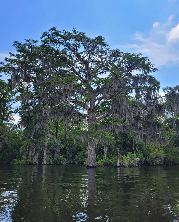
In some places, the ICW travels far inland and is dominated by freshwater habitat. This includes what is arguably the most breathtaking stretch of the waterway, the Waccamaw River just south of Myrtle Beach. The Waccamaw is a slow-flowing blackwater river, with water darkened from tannins picked up from fallen leaves in wooded swamps. The river is lined with towering bald cypress, which get their name from the fact that they drop their leaves in fall. These giants are majestic, with wide “buttresses” at the base of their trunk and “knees” – woody cones rising above the water’s surface around the base of the tree. These knees are thought to help aerate the root system. A stop at this serene anchorage allows boats to launch the dinghy and explore the many side creeks of the river, fish for largemouth bass or even striped bass during their spring and fall migrations, and spot birds like the swallow-tailed kite and wood stork.

For more information contact the Waccamaw National Wildlife Refuge at https://www.fws.gov/refuge/waccamaw. A public boat ramp at Enterprise Landing allows dinghies to be landed.
Salt Marsh: Duplin River, Mile 649
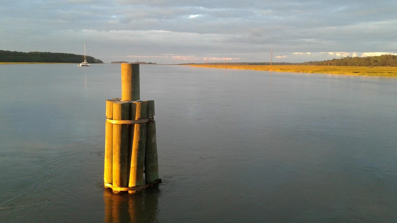
Anyone who has traveled the AICW through Georgia can tell you there are hundreds of anchorages hidden in the jumble of salt marsh creeks there. But a stop at the Duplin River anchorage puts you on the doorstep of the world-renowned University of Georgia Marine Institute on Sapelo Island, which conducts groundbreaking research into salt marsh ecology. The eight-foot tides here influence this habitat. At low tide, the banks of the salt marsh reveal a thick layer of pungent “pluff mud”, the remains of decomposed marsh grasses, scented by anaerobic bacteria. Pluff mud is so soft that it’s virtually impossible to walk through, so make sure you land the dink at a dock if you don’t want to sacrifice your footwear. Above the pluff mud, the shores are often lined with oyster reefs. These are also a bad place to land, as oyster shells are famously razor-sharp. The marsh proper is dominated by Spartina alterniflora – smooth cordgrass. This tall grass thrives in the water-logged, oxygen-poor soils of the marsh. An evening in the cockpit will be serenaded by the cackles of “marsh hens”, clapper rails that are often heard but rarely seen as they slip through the dense marsh grass.

Contact the Sapelo Island National Estuarine Research Reserve to learn about tours (https://sapelonerr.org/visit-sapelo-island/). A dinghy dock is available at the ferry terminal but should only be used in calm conditions.
Barrier Island: Cumberland Island, Mile 711
Almost anyone who stops at the anchorage west of Cumberland Island is enchanted. Cumberland Island, a national seashore, is the largest and southernmost barrier island in Georgia. Barrier islands are dominated by sand, created by waves depositing sediment. Georgia’s coastal geography favors the development of barrier islands, with flat terrain, a gently sloping continental shelf, and an abundance of river deltas carrying sediment to the sea. The geography of barrier islands is fickle; wind, waves, and tide shift them regularly.

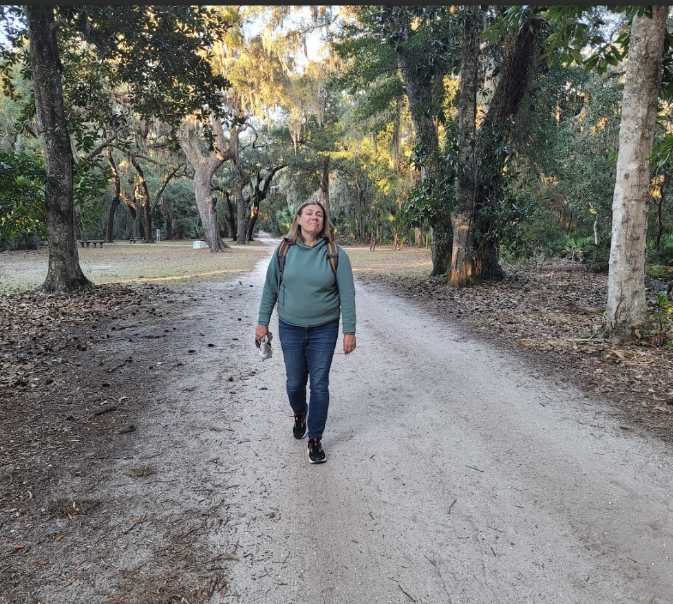
The anchorage here is typical of the backside of barrier islands on the east coast, with protected marshlands nestled between the mainland (St Mary’s) and the island. Venture ashore and three habitats stand out. The beaches at Cumberland Island are unparalleled. Access to these wide, hard-packed sandy beaches is limited, so you may be the only visitor to the beach. Nesting sea turtles, especially loggerheads, come ashore at night from May to midsummer, digging nests on the landward edge of the beach. These are carefully monitored and marked with stakes; some years more than 1000 nests are counted on the island. Behind the beaches, Cumberland is dominated by sand dunes. Sand dunes may be recently formed during the Holocene, or older, from the Pleistocene. Ancient dunes tend to be found further inland and can be very tall, up to 10 meters. The dunes are a hot, harsh environment, but are home to hardy succulents and cacti. Maritime forests are found on the west side of barrier islands in the southern US. Although this is the most stable part of barrier islands, the maritime forest is still a hard place to make a living, with strong winds, occasional flooding, and persistent salt spray. The maritime forest here is dominated by a dense understory of saw palmetto and a canopy of live oaks and magnolia draped in Spanish moss. A walk in the woods here may bring you face to face with an armadillo, deer, or even one of Cumberland’s famous feral horses.
For more information contact the Cumberland Island National Seashore at https://www.nps.gov/cuis/index.htm. Three dinghy docks are available; one at Sea Camp, one at Dungeness, and one at Plum Orchard.
Mangrove Forest: Vero Beach, Mile 952
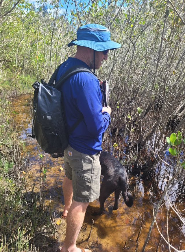
Mangroves can be found as far north as the Florida-Georgia border, but only thrive as “forests” south of St Augustine. Three types of mangroves can be found along the ICW. Red mangroves are the most salt-tolerant and their distinct arching, red “prop roots” make them easy to identify. Black mangroves are found higher above the tide-line than red mangroves, and have dark, finger-like projections rising from the surface, thought to help the plant absorb oxygen. White mangroves are found at the top of the tidal zone and lack visible roots. Together, these trees stabilize the shoreline, prevent storm damage, and provide excellent habitat for birds such as herons and roseate spoonbills as well as a diversity of both adult and juvenile fish. This anchorage (dominated by the municipal mooring field) is an outstanding place to immerse yourself in a mangrove forest. Dolphins are common visitors, hunting the rich waters around the mangroves. Anglers will find the mangrove-loving snook, gray snapper and crevalle jack hiding in the forest’s channels. A fun day trip in the dinghy takes you to Joe Erman Park on the Lost Tree Islands, where you can hike above the tide line and tiptoe through fiddler-crab colonies.

For more information about the mooring field, anchorage, and use of the dinghy dock in Vero Beach, contact the Vero Beach Municipal Marina at https://www.covb.org/231/Municipal-Marina.
Article by:
Damon & Janet Gannon
Bio:
We are a couple of sailing marine scientists/teachers/writers. We've been "sciencing" and sailing together for over 25 years. In 2023 they took a year off to go cruising aboard their current boat, a Pacific Seacraft 37 named Fulmar. Their canine crewmate is a fair-weather sailor who prefers inland waters. Check out their other blog on cruising and science, called Adventure Blue.


